Definitions used on the website are set out on this page. These definitions include the three key elements used to describe and identify facilities: world geography, mine ownership and mine infrastructure. The importance of these elements is reflected by their use as major menu items.
World Geography
World Size
To ensure that PMM has identified the entirety of world geography (land area), summarised data is compared to the United Nations Food and Agriculture Organisation (UN FAO) data. The following differences by continent are revealed:

Areas not included by the UN, but which are included by PMM are:
- Antarctica – 14,200,000 km2, and
- Disputed territories – 251,000 km2 (approximately)
Definition differences are explained by what land area (aka “surface area”) means – whether certain bodies of water are included or excluded.
Continents
Precious Metals Mining groups countries and their related external territories (collectively “political units”) into continents. Most people intuitively know: North America, South America, Africa, Europe, Asia, Australia and Antarctica as continents, see (National Geographic).
Precious Metals Mining uses an amended definition of continent to show both Russia and China separately as “continents”.
China is entirely contained within Asia, while Russia stretches across both Europe and Asia. However, the main reasons for separating them both out are: their geographic size, their geopolitical importance and their huge economic significance in precious metals mining.
Also Russia is identified separately from both Europe and Asia because precious metals are mined in central and eastern Russia mostly in: the Urals, Siberia or Far East Russia. These areas of Russia, while having land boundaries with Asian nations are not thought of as part of Asia and are certainly not part of Europe. Russia only mines very small volumes of precious metals in the “European” part of Russia.
The logic of separating China from the rest of Asia also relates to the immense economic influence the Chinese Communist Party (CCP) has over both domestic and global economic activity.
Additionally, PMM widens the base continent of Australia to include the whole of “Oceania”, thereby including all (non continental) Pacific Islands not grouped within “Asia excl. China”. Note that Hawaii is included as part of the “North America” continent, although geographically separate from that continent.
Importantly, New Zealand and Papau New Guinea are included in the continent of Oceania along with Australia. The border between Asia (excl. China) and Oceania splits the island of New Guinea at the border between Indonesia and Papua New Guinea.
India – a major producer of silver, but not gold, is not separated out as a “continent”. India is a major player in the gold market, but is nevertheless included within the continent “Asia (excl. China)”.
Finally, Precious Metals Mining provides a consistent orientation when looking at the world. This means looking at the world from “left to right” (or West to East) and “top to bottom” (or North to South) starting from the International Date Line and finishing in Antarctica. This also includes the orientation of looking at regions and individual countries within continents.
First level administrative divisions within each country are therefore viewed from “left to right and from top to bottom” – western style.
Number of Countries
Since the addition of South Sudan in 2011, the United Nations (UN) has had 193 members and 2 non-members. For completeness, Precious Metals Mining includes an additional 55 external territories, and 9 disputed territories.
Antarctica, itself a continent, is not specifically identified by the UN, because it is governed separately by countries which are parties to the Antarctic Treaty System.
In total, Precious Metals Mining identifies 259 entities, including external territories and disputed territories, therefore covering over 99% of the world’s land area:

The two UN non-members are: Palestine (West Bank and Gaza Strip, counted together as one) and the Holy See (Vatican City).
The additional fifty-five external territories are mostly a legacy of the European colonial era and are grouped into categories based on their “controlling state(s)” and legal status. For example, Britain’s external territories are grouped separately into: Crown Dependencies and British Overseas Territories. France’s territories are split across four groupings.
Antarctica is shown as a single entity although there are numerous individual regions administered by different countries. The treaty governing Antarctica determines that no mining takes place on the continent.
The nine disputed territories (which does not include the current on-going Ukraine/Crimea conflict) are :

There are many more territories whose status is currently in dispute (check Wikipedia for a full list). However, the nine disputed territories listed above are states that the UN determines are “not UN members or observers”.
The International Bank for Reconstruction and Development within the World Bank currently recognises 189 members. These are the 193 UN members, but do exclude: Andorra, Cuba, Liechtenstein, Monaco and North Korea, and includes Kosovo.
Administrative Divisions
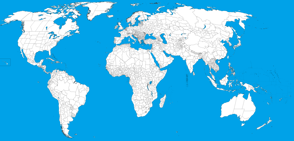
Precious Metals Mining builds it’s view of the world from the bottom up, wherever practical, based on first level administrative regions within a country or dependency. Specific examples include: the states of the United States, the provinces of Brazil, the governates of Egypt, the counties of Sweden, the emirates of Saudi Arabia, the oblasts of Russia, the departments of Bolivia and Colombia, the municipalities of Greenland, the autonomous regions of China and even the regions of the Antarctic Treaty System (not shown in the map below).
If a country or external territory is relatively small in size (typically less than 100,000 km2) and/or has no recorded precious metal deposits, then it is not broken down into it’s first level administrative divisions. These countries represent just over 100 of the 259 entities identified above.
Land Areas not included
The 259 political units represent the vast majority the world’s land area, not entirely 100%. This is because there are small islands, which are known to be not included, for example:
- Scattered French Islands in the Indian Ocean, which include four coral atolls, not included in the external French territories.
- Clipperton Island, a coral atoll in the Pacific Ocean, off Mexico, which is an “overseas state private property” of France.
Mine Infrastructure
Mine infrastructure can be measured in terms of either current annual production or mineral resources and ore reserves (potential future production).
Annual Production
The output of mines is measured by annual production figures. By definition, projects have no current production (although in reality they often have small amounts of production for testing and sampling).
A facility’s annual production (output) is volume (in fine weight) mined. It is usually measured in troy ounces or kilograms (1,000 kg or 32,151 troy oz of fine gold = 1 metric tonne).
Production reporting is based on calendar years, with most mining companies adopting this reporting cycle. Companies in countries with alternative year ends (for example June, is typical in both South Africa and Australia, March for Japan) have been adjusted to calendar year reporting.
Annual production – simplifying assumptions:
- Gold and silver can be produced while a deposit is still being developed as a project but typically not in volumes which will impact the numbers on a regional or global level
- Where there are large amounts of mined material (stock) ready to be processed, these are assumed to be the same at the end of the year as at the beginning of the year.
Mineral Resources and Ore Reserves (MROR)
What is MROR?
MROR is a means of measuring the size of a mining deposit.
The focus of this site is annual production volumes of precious metals. However, successful production relies on the completion of a series of stages in a project from exploration to production.
The deposit size can never be fully known until the material is extracted, so the numbers are based on specified levels of confidence. Even after the material is extracted, it is not uncommon to find more Mineral Resource and Ore Reserves.
At the lowest level of confidence are Inferred Mineral Resources.
At the next level of confidence – Indicated Resources are where an estimate has been made.
Measured Resources are Indicated Resources which have been sampled and provide the highest level of confidence. This happens regularly when a mine is in production.
An Ore Reserve is the economically mine-able part of a Measured and/or Indicated Mineral Resource and allows for certain adjustments for expected losses etc.
Ore Reserves split into equivalent levels of confidence to Mineral Resources, with Probable being equivalent to Indicated and Proven being equivalent to Measured.
For a detailed explanation of MROR refer to one of the major standard setting authorities like www.jorc.org
Project Stages
The chart below identifies the technical stage a project must go through in order to develop to production. These include “mineral resource”, “preliminary economic assessment” (pea) and “mineral reserve”, which represent increasing levels of confidence regarding the economic viability of the project.

Mine Ownership
Ownership Models
In the large scale mining (LSM) context, there are publicly quoted, private and state owned enterprises.
- Publicly Owned Enterprises are listed on a Stock Exchange,
- State Owned Enterprises can be either federal (national) or state based, and
- Privately Owned Enterprises
ASM is a separate category to LSM. In the artisanal and small scale (ASM) space, the scope ranges from formal ASM (manual/artisanal and small scale mechanised) to illicit gold mining (working outside the law). ASM is illicit where it is explicitly prohibited by that country’s domestic legislation.
- ASM is associated with the region in which the mine is located. No specific enterprise is identified. Cooperative mining and other small scale community-based mining is included within ASM.

Ownership Categories
A more detailed look at scale withing LSM allows us to split LSM into: Major, Intermediate and Junior categories. These categories largely speak for themselves, but typically, what they mean is:
- Major are large organisations with a global reach, multiple mines and projects across multiple PU‘s/countries. On this site, to be a major, a company must have gold production of >1moz or silver production >20moz in the last five years
- Intermediate organisations with mines and projects in production but which are not majors, and
- Junior companies are exclusively involved in exploration or development (i.e. no mines yet in production).
In addition companies can be broken down into either “primary” or “secondary” types:
- Primary (mining companies whose primary objective is to explore, develop or mine gold and/or silver), and
- Secondary (any companies whose secondary objective is to explore, develop or mine gold and/or silver). In other words, gold and silver are a by-product of their primary mining activity, be that mining or investment in mining. These activities mostly include copper, zinc, lead and pgm mining.
Restating Production Figures
From time to time, all three key elements (world geography, mine infrastructure and mine ownership) used to describe and identify facilities may change. Changes to historical production figures are made based on whether the revision makes more sense when looking at future production.
- changes in World Geography happen from time to time. Countries may change name (e.g. “Turkey” to “Türkiye”), new countries emerge (e.g. South Sudan split out of Sudan). In these cases, it is normal to restate historical production figures based on the new, updated view of the world.
- in Mine Infrastructure over time certain deposits may be split or consolidated based on the commercial or legal requirements of the time. Where necessary, historical production figures are based on the updated view of the world.
- reflecting changes in Mine Ownership is more contentious. PMM restates historical production figures to reflect the updated scenario. Significantly, since the Russian invasion of Ukraine, the ownership of a number of Russian assets have dramatically morphed. These include:
- Kinross has sold their Russian assets to Highland Gold (Rusdragmet) and,
- Polymetals Intl plc have changed their name to Solidcore Resources, change stock exchange to Astana Stock Exchange (in Kazakhstan), and sold their Russian assets to Mangazeya Mining
- Trans-Siberian Gold now operates as a subsidiary of a private Russian company Horvik.
- Petropavlovsk plc became Atlas Mining, which sold it’s Russian assets to Ural Mining (UMMC).
Leave a Reply
You must be logged in to post a comment.